Episode 1: Earliest fossils and the hunt for extraterrestrial life
You may be forgiven for having missed the news of NASA’s Curiosity rover, or Mars Science Laboratory (MSL), having landed on Mars, given all the coverage the 2012 Olympics had been getting.
To try and even this up, we got in touch with Dr. Leila Battison, a palaeontologist from the University of Oxford, UK, who is currently working at NASA, researching the earliest life in the fossil record and the conditions it needed to survive. We discussed NASA’s mission to Mars and explored what kind of things we could expect from any signs of life on another planet based on what we know about early life on Earth from the fossil record.
Podcast: Download (Duration: 1:00:15 — 55.2MB)
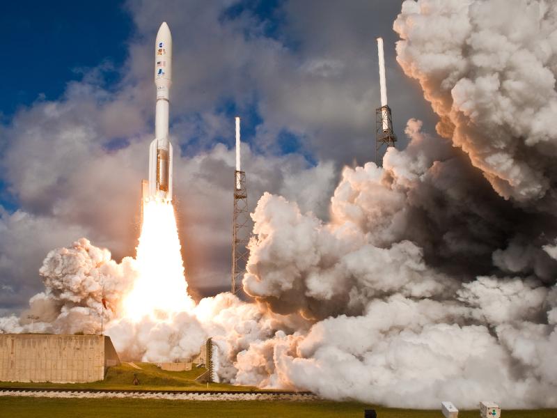
NASA’s Mars Science Laboratory spacecraft, sealed inside its payload fairing atop the United Launch Alliance Atlas V rocket, clears the tower at Space Launch Complex 41 on Cape Canaveral Air Force Station in Florida.The mission lifted off at 10:02 a.m. EST (7:02 a.m. PST), Nov. 26, beginning an eight-month interplanetary cruise to Mars. Image credit: United Launch Alliance
This video steps viewers through a portion of the choreography needed to land NASA’s Curiosity rover on Mars. It starts with a computer simulation from NASA’s Eyes on the Solar System program and uses actual images from Curiosity’s Mars Descent Imager. It ends with a high-resolution color image from Curiosity’s Mast Camera. Video Credit: NASA/JPL-Caltech

Engineers at NASA’s Jet Propulsion Laboratory in Pasadena, California, celebrate the landing of NASA’s Curiosity rover on the Red Planet at 05:32 GMT on the 6th August 2012. Image credit: NASA/JPL-Caltech
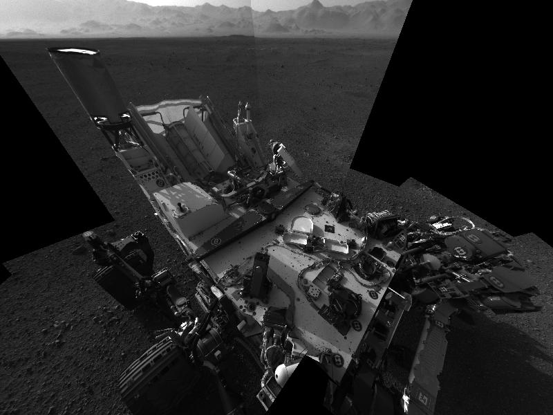
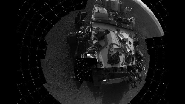
This full-resolution self-portrait shows the deck of NASA’s Curiosity rover from the rover’s Navigation cameras. The back of the rover can be seen at the top left of the image, and two of the rover’s right side wheels can be seen on the left. Part of the pointy rim of Gale Crater forms the lighter color strip in the background. Bits of gravel, about 0.4 inches (1 centimeter) in size, are visible on the deck of the rover. Image credit: NASA/JPL-Caltech
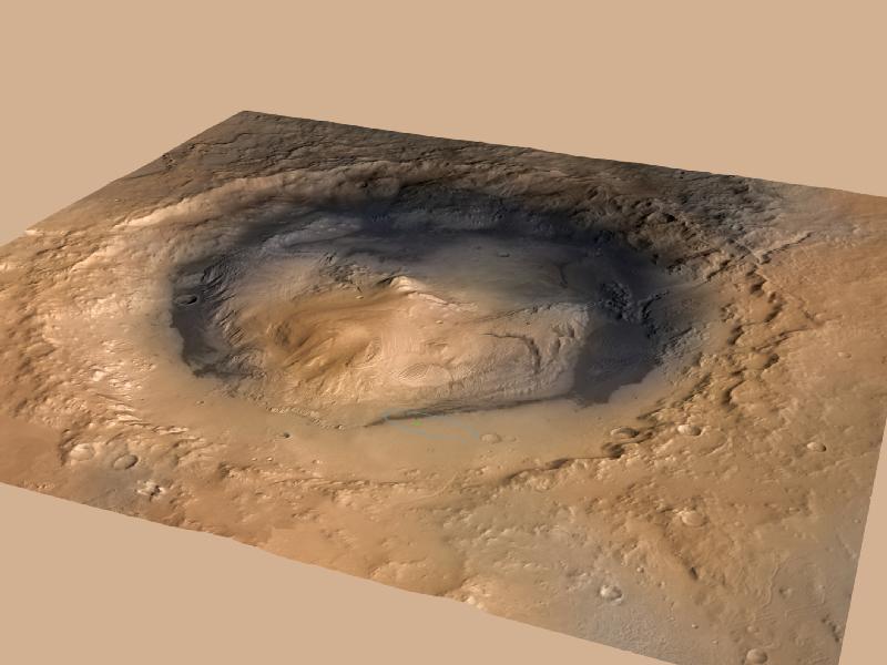
The rover landed in a large depression called Gale Crater. At the center is Mount Sharp, which rises about 3.4 miles (5.5 kilometers) above the floor of Gale Crater. This oblique view of Gale, and Mount Sharp in the center, is derived from a combination of elevation and imaging data from three Mars orbiters. The view is looking toward the southeast. Image credit: NASA/JPL-Caltech/ESA/DLR/FU Berlin/MSSS
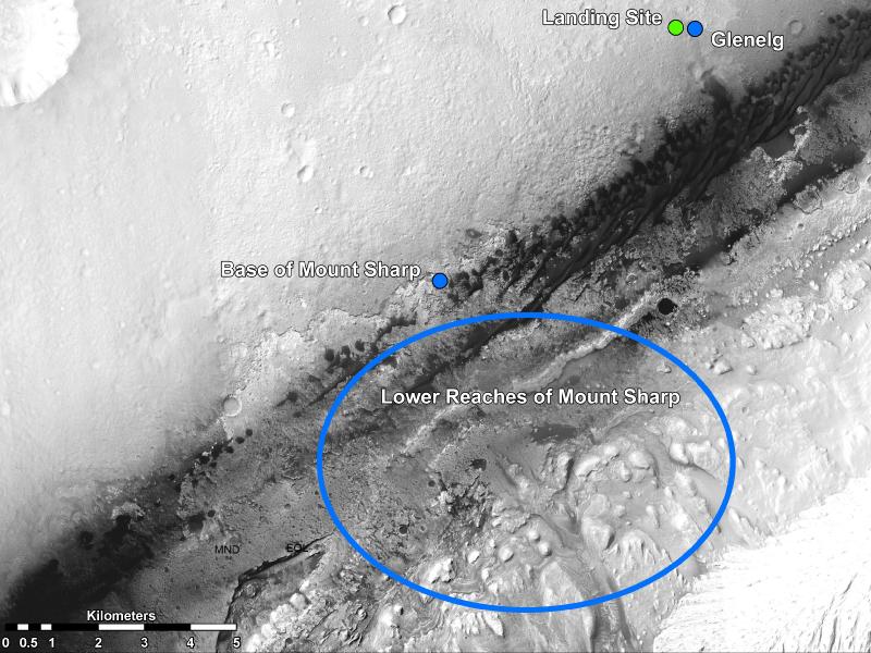
This image shows the landing site of NASA’s Curiosity rover and destinations scientists want to investigate. The team has chosen for it to move toward the region marked by a blue dot that is nicknamed Glenelg. That area marks the intersection of three kinds of terrain. Then, the rover will aim to drive to the blue spot marked “Base of Mt. Sharp”, which is a natural break in the dunes that will allow Curiosity to begin scaling the lower reaches of Mount Sharp. At the base of Mt. Sharp are layered buttes and mesas that scientists hope will reveal the area’s geological history. Image credit: NASA/JPL-Caltech/Univ. of Arizona
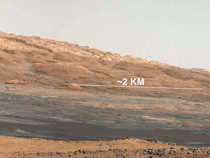
This image (cut out from a mosaic) shows the view from the landing site of NASA’s Curiosity rover toward the lower reaches of Mount Sharp, where Curiosity is likely to begin its ascent through hundreds of feet (meters) of layered deposits. The lower several hundred feet (meters) show evidence of bearing hydrated minerals, based on orbiter observations. The terrain Curiosity will explore is marked by hills, buttes, mesas and canyons on the scale of one-to-three story buildings. Image credit: NASA/JPL-Caltech/MSSS
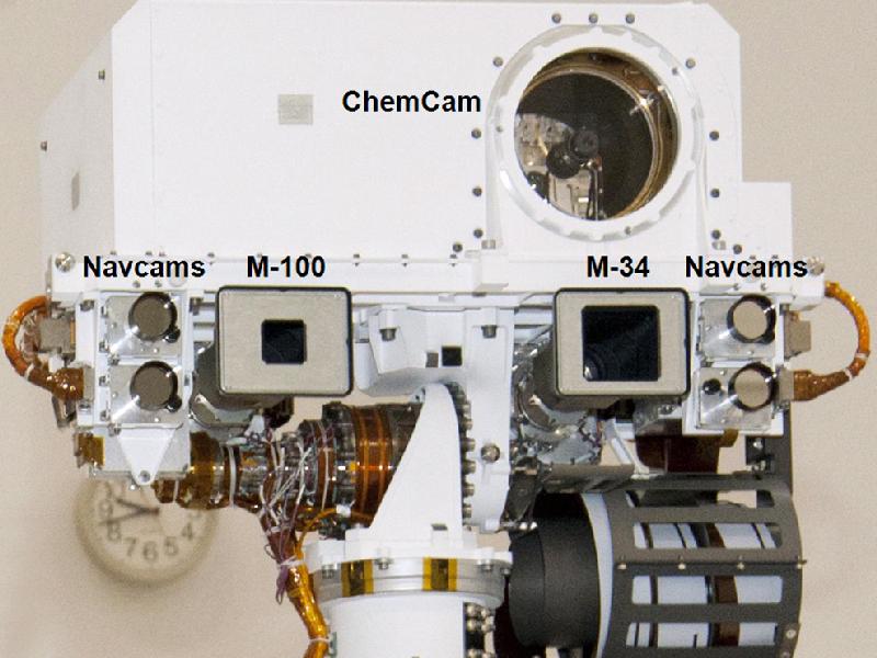
This view of the head of the remote sensing mast on the Mars Science Laboratory mission’s rover, Curiosity, shows seven of the 17 cameras on the rover. Two pairs of Navigation cameras (Navcams), among the rover’s 12 engineering cameras, are the small circular apertures on either side of the head. On the top are the optics of the Chemistry and Camera (ChemCam) investigation, which includes a laser and a telescopic camera. The Mast Camera (MastCam) instrument includes a 100-millimeter-focal-length camera called MastCam-100 or M-100, and a 34-millimeter-focal-length camera called the MastCam-34 or M-34. The two cameras of the MastCam are both scientific and natural color imaging systems. The M-100 looks through a 1.2-inch (3-centimeter) baffle aperture, and the M-34 looks through a 2.1-inch (5.3-centimete) baffle aperture. Image Credit: NASA/JPL-Caltech/LANL
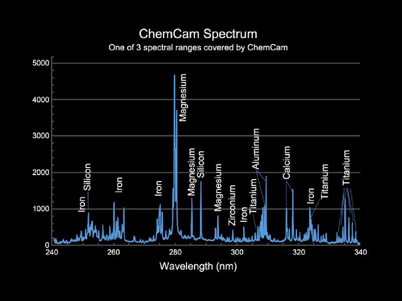
This is an example of the type of data collected by the Chemistry and Camera (ChemCam) instrument on the Mars Science Laboratory mission’s Curiosity rover. The instrument uses a laser to generate a flash of ionized plasma on a target rock, while observing the target with spectrometers receiving light through a telescope. Peaks in the intensity of light emitted at specific wavelengths are indicators of specific chemical elements in the target. Image Credit: NASA/JPL-Caltech/LANL
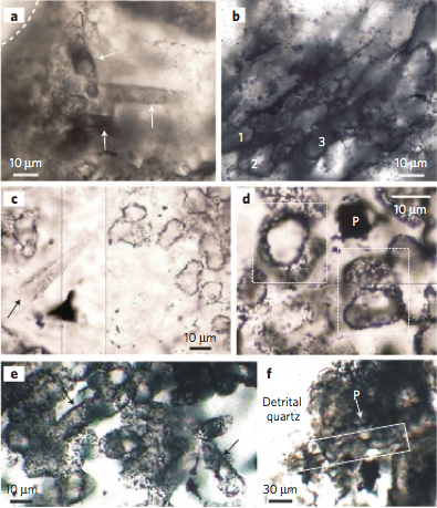
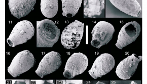
The oldest microfossils we know of are these spheres and tubes, probably representing sulphur-metabolising bacteria. They are found in 3.4 billion-year-old rocks from western Australia. Image Credit: Nature
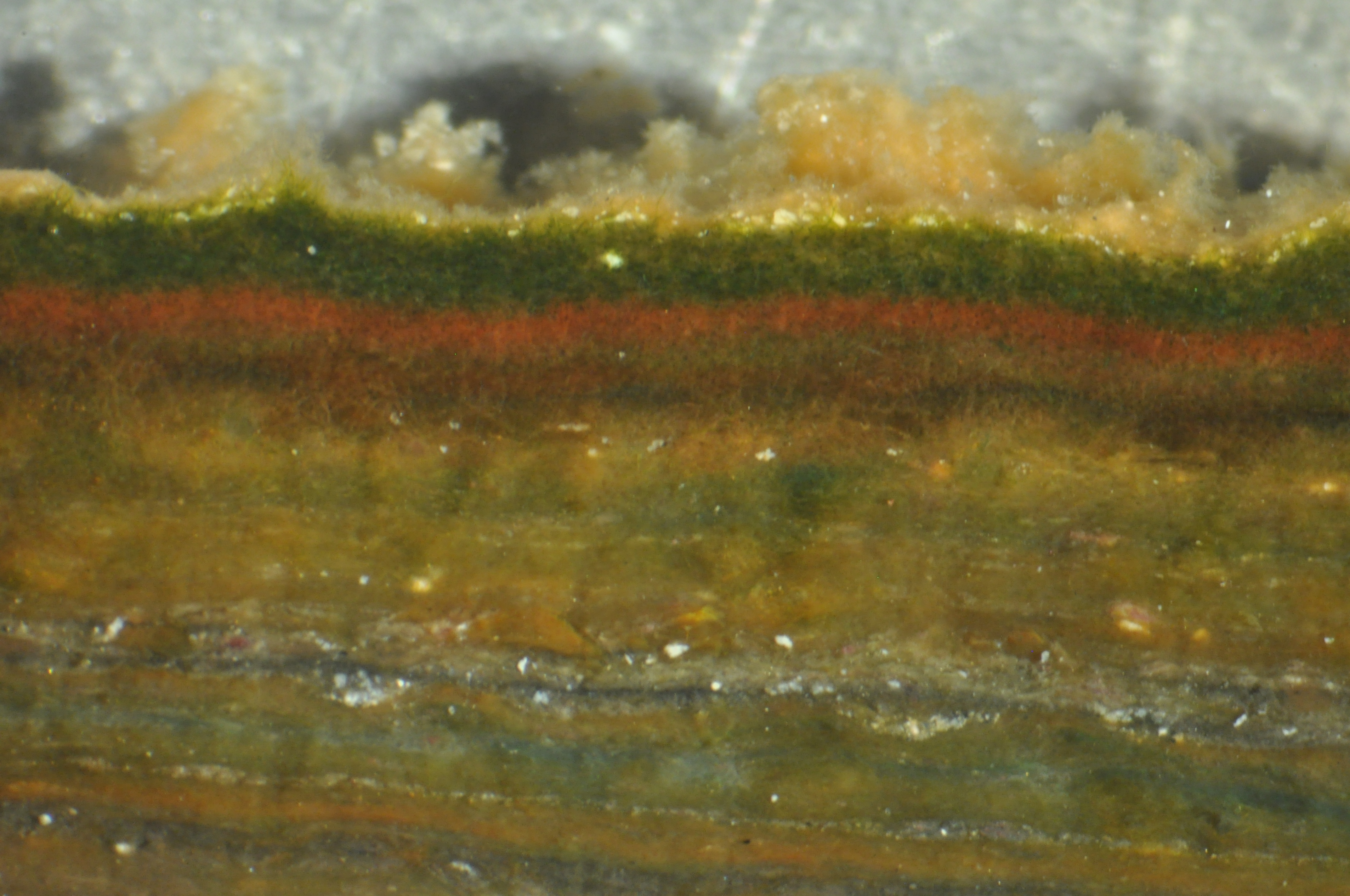
Purple sulphur-metabolising bacteria, making up the thin pink line just beneath the surface of this microbial mat, were symbiotically incorporated into proto-eukaryotic cells, to become mitochondria. Image Credit: Leila Battison/Bebout Lab
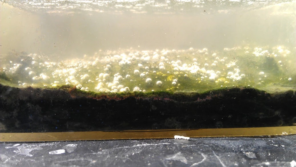
Microbial mats are complex ecological communities of microbes, often layered according to the available energy sources and nutrients. This mat from salt ponds in Baja California has photosynthesising cyanobacteria at the top, and pink sulphur bacteria beneath. Image Credit: Leila Battison/Bebout Lab
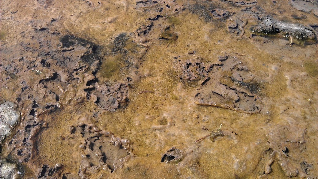
Photosynthesising microorganisms form thick gelatinous mats that cover the sediment surface. These mats from California grow in the nutrient-rich waters of an estuary, and help us to understand the evolution of photosynthesis. Image Credit: Leila Battison/Bebout Lab
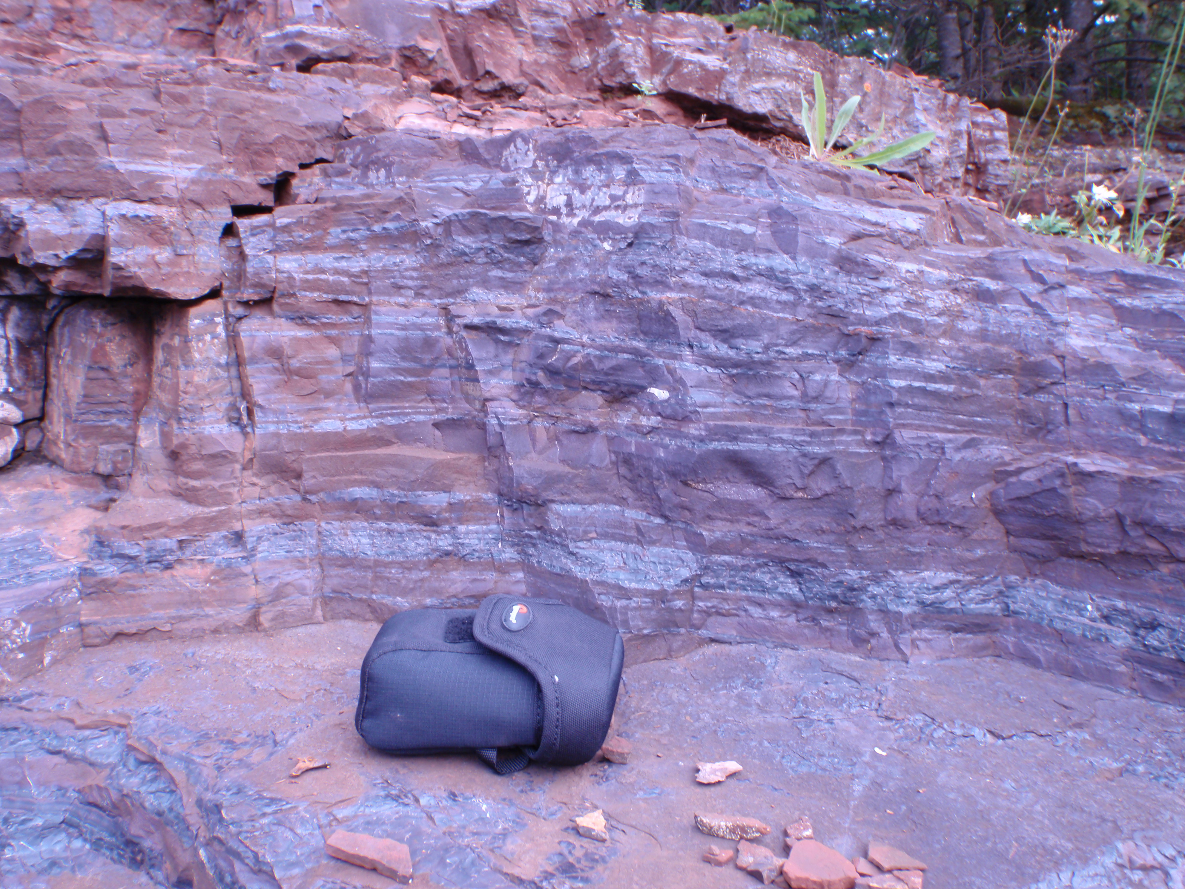
Rocks, such as these Banded Iron Formations from the 2 billion year old Gunflint Formation in Ontario, formed when the first free oxygen in the atmospheres and oceans combined with iron and was deposited. These rocks can indicate the presence of life without actual fossilised remains. Image Credit: Leila Battison
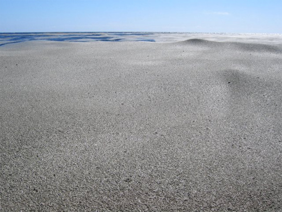
Pumice thrown out from volcanoes can float as huge rafts on the surface of the ocean for many hundreds of years, and may be an ideal location for the origin of life. Image Credit: USGS
Related Posts

Episode 123: Soil →
Episode 104: Ediacaran Developmental Biology →
Episode 97: Opsins →